10. Batura Sar

Batura Sar, also referred to as Batura I, is the 25th highest mountain on earth[1] and the 10th highest in Pakistan. It is the highest peak of the Batura Muztagh, which is the westernmost subrange of the Karakoram range. It forms the apex of the Batura Wall, which is a continuously high part of the backbone of the Batura Muztagh. Alternate forms of the name of this peak are Batura, Batura I, and Batura I East.
9. Masherbrum

Masherbrum (also known as K1) is located in the Ghanche District, Gilgit Baltistan of Pakistan. At 7,821 metres (25,659 ft) it is the 22nd highest mountain in the world and the 9th highest in Pakistan. It was the first mapped peak in the Karakoram mountain range, hence its name.
8. Khunyang Chhish
Khunyang Chhish or Kunyang Chhish is the second-highest mountain in the Hispar Muztagh, a subrange of the Karakoram mountains of Pakistan. Alternate variations of the name include Kunyang Kish and Khiangyang Kish, among others. Its height is also sometimes given as 7823m. It is ranked 21st in the world and 8th in Pakistan.
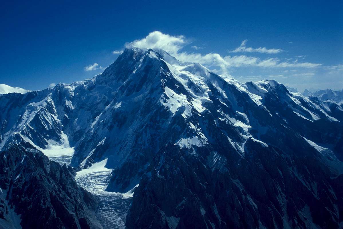
7. Distaghil Sar

Disteghil Sar or Distaghil Sar is the highest mountain in the Hispar Muztagh, a subrange of the Karakoram mountain range, in Gilgit-Baltistan. It is the 19th highest mountain on earth and the 7th highest peak in Pakistan. The mountain has an about 3 km long top ridge above 7400m with three distinct summits: (north)west 7885m, central 7760 m, and (south)east 7696m or 7535m
6. Gasherbrum IV
Gasherbrum IV is the 17th highest mountain on Earth and the 6th highest in Pakistan. It is one of the peaks in the Gasherbrum massif.
5. Gasherbrum II

Gasherbrum II , also known as K4, is the 13th highest mountain in the world at 8,035 metres (26,362 ft) above sea level.[1][2][3][5] It is the third-highest peak of the Gasherbrum massif, and is located in the Karakoram range of the Hindu Kush, on the border between Gilgit–Baltistan province, Pakistan, and Xinjiang, China.[3][6] The mountain was first climbed on July 7, 1956, by an Austrian expedition which included Fritz Moravec, Josef Larch, and Hans Willenpart.
4. Broad Peak
Broad Peak also known as K3, is the 12th highest mountain in the world at 8,051 metres (26,414 ft) above sea level. The literal translation of “Broad Peak” to Falchan Kangri (ཨིྰན་ཨངརི་) is not accepted among the Balti people.[3] The English name was introduced in 1892 by the British explorer Martin Conway, in reference to the similarly named Breithorn in the Alps.
3. Gasherbrum I

Gasherbrum I, also known as Hidden Peak or K5, is the 11th highest mountain in the world at 8,080 metres (26,510 ft) above sea level. It is located on the Pakistani–Chinese border in Gilgit–Baltistan region of Pakistan and Xinjiang region of China. Gasherbrum I is part of the Gasherbrum massif, located in the Karakoram region of the Himalaya. Gasherbrum is often claimed to mean “Shining Wall”, presumably a reference to the highly visible face of the neighboring peak Gasherbrum IV; but in fact it comes from “rgasha” (beautiful) + “brum” (mountain) in Balti, hence it actually means “beautiful mountain.”
2. Nanga Parbat
Nanga Parbat (literally, Naked Mountain Urdu: نانگا پربت [nəŋɡaː pərbət̪]) is the ninth highest mountain in the world at 8,126 metres (26,660 ft) above sea level. It is the western anchor of the Himalayas around which the Indus river skirts into the plains of Pakistan. It is located in the Gilgit-Baltistan region of Pakistan, and is locally known as ‘Deo Mir’ (‘mir’ meaning ‘mountain’).
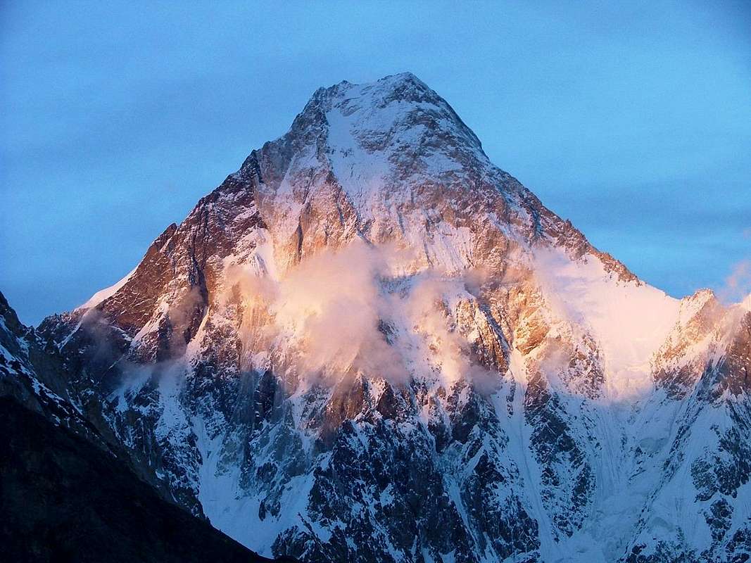
1. K2
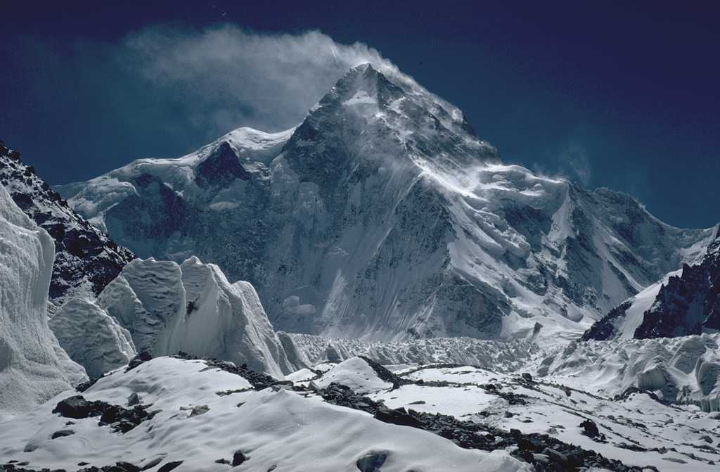
K2, also known as Chhogori/Qogir, Ketu/Kechu, and Mount Godwin-Austen(Native Balti name:Chhoghori)(Balti/Tibetan scrpit: ཆོ་གོ་རི) (Urdu: چھوغوری ),[2] is the second highest mountain in the world at 8,611 metres (28,251 ft), after Mount Everest. It is located on the border[3] between Baltistan, in the Gilgit–Baltistan region of northern Pakistan, and the Taxkorgan Tajik Autonomous County of Xinjiang, China. With a peak elevation of 8,611 m (28,251 feet), K2 is the highest point of the Karakoram Range and the highest point in Pakistan.
No comments:
Post a Comment