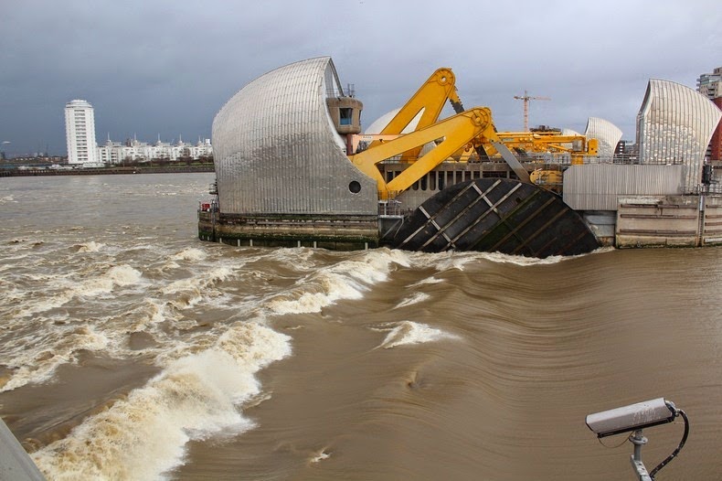
The Thames Barrier is located downstream of central London, on the river Thames on the eastern side of the capital at Woolwich. It is the world's second largest after the Oosterscheldekering barrier in the Netherlands. The barrier was built in 1982 to prevent folding of all but the easternmost boroughs of Greater London by exceptionally high tides and storm surges moving up from the North Sea. The barrier is made up of 9 steel gates reaching 520m across the river. When open, the gates lie flat on the river floor allowing the Thames to flow freely and ships to pass through the gates. When closed, the gates are rotated upwards until they block the river. The gates, which are hollow and made of 1.6 inch-thick steel, span 61 meters and each weigh 3,200 tonnes. The gates are filled with water when submerged and empty as they emerge from the river.

Flooding has been a problem in London for centuries. The threat has increased over time due to the slow but continuous rise in high water levels the slow "tilting" of Britain - up to 5 cm/100 years - caused by post-glacial rebound. The 1928 Thames flood claimed the lives of 14 people, and 307 people died in the UK in the North Sea flood of 1953.
Construction on the Thames Barrier began in 1974 and was officially opened a decade later. The barrier was originally designed to last up to the year 2030, but recent analysis suggests that barrier will be sufficient protection until 2060-70.


Graphics credit: The Guardian

Graphics credit: BBC


Flood barrier open. Photo credit

Flood barrier closed. Photo credit


No comments:
Post a Comment