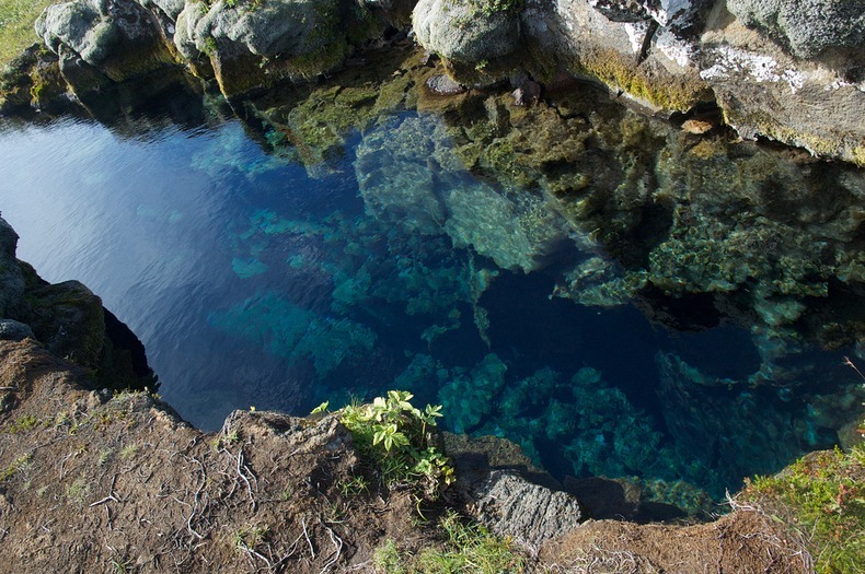
Located in the Thingvallavatn Lake in the Thingvellir National Park in Iceland, Silfra is part of the Atlantic rift – the dividing line between the continents of Europe and America. It’s a huge crack in the earth’s surface, where the continental plates meet and which is slowing widening by about two centimeters per year. In the deep waters of the Atlantic Ocean this crack is mainly unseen, but at Silfra, clear melt water of Icelandic glaciers make the rift visible.
The amazing visibility and accessibility makes Silfra a popular diving spot. Divers and snorkelers can float between the American and Eurasian tectonic plates and at places, can actually touch both continents at the same time. The visibility is extraordinary at nearly 100 meters. The reasons for this outstanding clarity are two-fold. First, the water is cold - 2º and 4ºC – and remains at this temperature all year round. The coldness keeps the water free of aquatic life. Secondly, the water itself is of the purest form. It begins as distilled water when the leading edge of the glacier melts high up on the Hofsjokull mountain, 50 km away. This water then disappears and runs underground, to emerge once again in the Thingvellir national park. On its journey it is constantly filtered by porous lava rock, until is becomes so pure that it can be drunk without any form of treatment.

The Mid Atlantic Ridge is the longest mountain range in the world but for the most part, it is submerged deep beneath the surface of the Atlantic Ocean. The ridge includes a deep rift valley which runs along the axis of the ridge along nearly its entire length. This rift marks the actual boundary between the two tectonic plates - the Eurasian and the American. Right between the tectonic plates lava underneath the earths crust flows out into the ice cold water of the Atlantic. The lava coalgates instantly and over millions of years this process has formed the Atlantic Ridge.
Although many people have dived at Silfra, very few have ventured deep into the Silfra cave which is at least 63 meters deep. The high depth and very narrow passages pose high risk for divers. Besides, the rocks that form the cave could be loose and collapse. The cave has been mapped by a group of American cave divers, but regular earthquakes in the area and the diverging tectonic


No comments:
Post a Comment